I did not begin by trying to read Dighton Rock. I began by asking which lines were actually on it. That change in method broke the mystery open. The famous boulder has been copied for more than three centuries, but the copies disagree. Every age found the alphabet it expected: Phoenician letters, Norse runes, Portuguese names, Hebrew history, or proof of an unknown Atlantic visitor. The rock remained in the river while the drawings traveled—and the traveling drawings acquired a life of their own.
The original object is a forty-ton, gray feldspathic boulder from the tidal Taunton River at Berkley, Massachusetts. Its carved face is about eleven feet wide and six feet high. Human-like figures, animals, X forms, lines, circles, and other shallow marks cross the surface. Some may have been added at different times. None forms the clean, continuous foreign-language inscription that old reconstructions taught readers to expect.
My investigation therefore treats the rock as a palimpsest and its archive as a second artifact. I follow the waterline, compare the 1680 record with later drawings, reconstruct how light and chalk changed observation, and test the Norse and Portuguese readings against their source images. The result restores a conclusion long displaced by romantic theories: the principal petroglyphs are Indigenous, most plausibly connected to Native people of southern New England. What remains uncertain is the precise date, sequence, and meaning of individual figures.
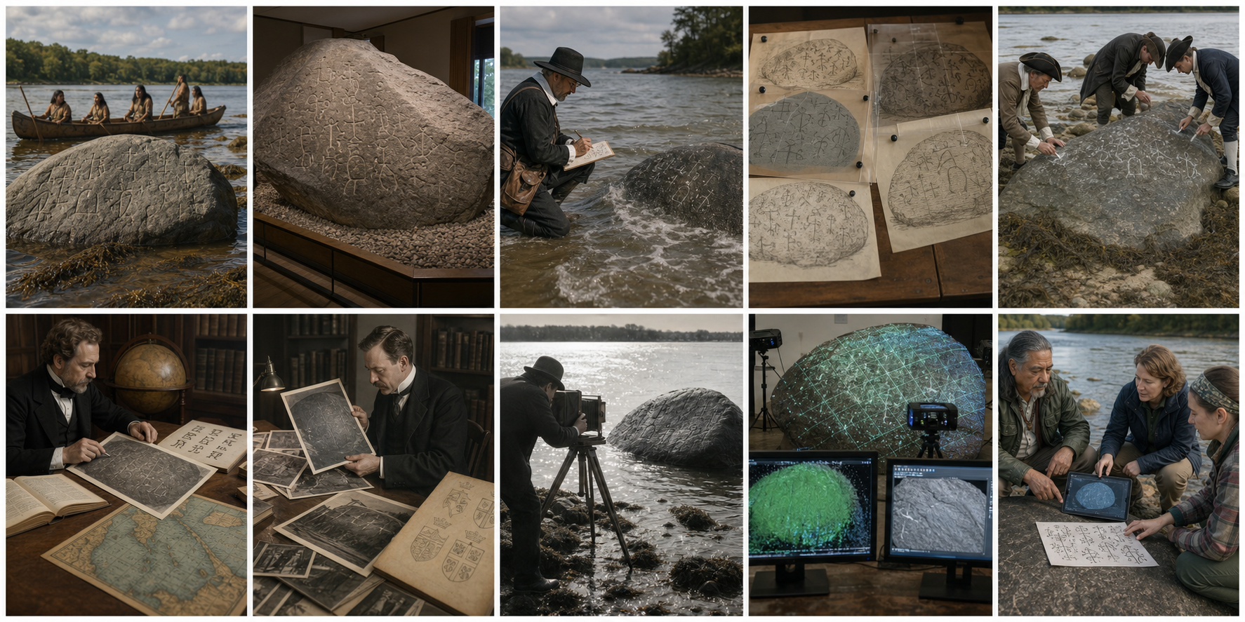
Before it became an antiquarian puzzle, the boulder occupied a Native river landscape. Its carved face looked toward a route used for travel, fishing, exchange, and ceremony.
The scene the old theories cropped away
The Taunton is not an empty backdrop. The lower river widens toward Mount Hope Bay and Narragansett Bay, linking inland settlements with salt water. Long before English colonization, Wampanoag and neighboring Native communities moved through, named, harvested, and understood this landscape. A marked boulder at a navigable river therefore begins with an Indigenous context, not with a hypothetical ship from Europe.
The 2022 Massachusetts Department of Conservation and Recreation management plan explicitly connects the petroglyphs, the river, and Native use of the place. It calls for Native voices to be central in interpretation. That is not a ceremonial addition to a European mystery; it corrects the way the object was removed conceptually from the people whose territory surrounded it.
The rock originally stood partly in the tidal zone. At high water, some markings disappeared. At low water, mud, weed, spray, and reflected sky complicated the view. Anyone making a record had a limited window and an awkward surface. The carved field is curved and mineral-grained rather than a prepared tablet. A line that appears continuous under one angle can dissolve under another.
Raking light in the museum reveals overlapping shallow grooves. The surface is not a single paragraph; it is a field of marks with different depths, directions, and histories.
A boulder, not a stone document
Dighton Rock is often introduced as though it bears “an inscription.” That singular noun quietly imposes unity. It encourages us to search for one author, one date, one language, and one message. The visible reality is less orderly. Figures overlap. Some grooves are clearer than others. Natural cracks cross human marks. Later graffiti may occupy the same face.
A petroglyph is an image or mark made by removing part of a rock surface—pecking, incising, abrading, or carving. Petroglyph traditions around North America include schematic humans, animals, tracks, weapons, celestial shapes, tally-like strokes, and abstract geometry. They need not behave like alphabetic writing, and they need not translate into a sentence.
The word “hieroglyphic” in early descriptions also created a trap. Seventeenth- and eighteenth-century writers used it broadly for strange picture-like marks. Later readers sometimes treated the term as evidence of Egyptian or Old World script. It was an observer's category, not an identification.
When Massachusetts built Dighton Rock State Park, the purpose was preservation. The state removed the boulder from the river in 1963 and housed it nearby. The Harvard Gazette's account of a 2017 conservation visit records both the forty-ton move and a modern archaeological explanation of the 3-D imaging. Today the object is protected from tides, ice, and casual re-marking, but that protection came after centuries of exposure.
In 1680 John Danforth made the earliest surviving field drawing. Rising water, limited light, perspective, and a wet curved surface shaped what his paper preserved.
October 1680: the first surviving witness
Reverend John Danforth's 1680 sketch is usually treated as the starting point of the documentary record. It is precious because it predates the great waves of antiquarian theory. It is also incomplete. Danforth drew the upper portion that he could observe, while lower areas may have been hidden or difficult to reach. His copy survives in the British Museum and already differs from later renderings.
Cotton Mather described the rock in 1690 as a mighty stone by a river, covered at high tide and deeply engraved with strange characters. His description verifies early colonial awareness, not the identity of the carvers. The phrase “no man alive knows how or when” says more about the colonists' lost access to local knowledge after war, disease, and dispossession than about a vanished European civilization.
Danforth was not using photogrammetry. He selected boundaries, simplified texture, and converted a curved surface into a flat page. If he saw a faint segment between two grooves, he had to decide whether it belonged. Omitting it produced one symbol; adding it produced another. Every pen stroke was simultaneously observation and interpretation.
The value of the drawing lies in its honest limitations. It shows that some marks existed by 1680 and gives a rough distribution. It cannot certify that every illustrated line was precisely located or that unillustrated areas were blank.
Archive overlays expose the instability: copies said to represent the same face contain different connections, figures, proportions, and even reading directions.
The copies fail a simple registration test
I aligned descriptions of major historic copies conceptually—Danforth's sketch, eighteenth-century drawings connected with Ezra Stiles and others, the 1830 Rhode Island Historical Society record, later published plates, photographs, tracings, and Delabarre's diagrams. The same clusters change identity from one sheet to another. An arc becomes a letter. Disconnected scratches become a profile. A figure acquires a crown or weapon. A Roman-looking numeral appears or vanishes.
The Colonial Society of Massachusetts published a meticulous documentary review in the early twentieth century. Its 1916 discussion of early records stresses how little secure material existed and how attributions of drawings became confused. Its 1919 continuation follows the increasingly elaborate interpretations and concludes that comparison with Indigenous picture-writing had established the origin of most, if not all, of the marks.
This archive has a peculiar asymmetry. A copy can invent a line once, and later scholars may faithfully reproduce the invention. Repetition then makes the line look well attested, even though every version descends from the same mistake. Ten printed plates do not equal ten observations if nine copied the first.
| Recording method | What it preserves | What it can add or lose |
|---|---|---|
| Freehand field sketch | General layout and recognizable forms | Scale drift, selective attention, imagined connections |
| Chalked tracing | Lines chosen by the tracer | Natural cracks promoted to carvings; faint grooves excluded |
| Rubbing or contact cast | Local relief on accessible areas | Distortion over curvature; damage or contamination |
| Early photograph | Light reflected at one moment | Glare, reversal, low contrast, hidden submerged areas |
| 3-D scan | Dense surface geometry at measured points | Still requires classification of natural and human features |
Chalk and tracing can make a faint pattern legible for an audience, but they also convert the observer's decision into a bright “fact” on the stone.
The observer enters the inscription
Before controlled digital recording, investigators often wetted, chalked, painted, scraped, rubbed, or molded carved surfaces. These methods improved contrast for drawings and cameras. They also altered the visual field and sometimes the rock itself. Once chalk filled a suspected groove, the next viewer saw the chalk line first and the surface second.
Expectation guides the hand. A scholar searching for Latin letters is more likely to connect three short strokes into an M. A runologist completes a broken angular form. A heraldry enthusiast closes a shield. This is not necessarily fraud. It is a normal perceptual effect made durable by tracing.
Dighton Rock behaves like a massive Rorschach test because it supplies many weak edges. Natural joints, mineral boundaries, pecked shapes, colonial initials, weathered Indigenous figures, and later damage share the same surface. The human visual system rewards coherent objects. It would rather see a soldier, ship, date, or sentence than a field of uncertain strokes.
Carl Christian Rafn approached American antiquities after building a real case for Norse voyages. That success made the unrelated marks on Dighton Rock easier to recruit into a Norse story.
The Norse reading borrowed authority from a true discovery
Danish scholar Carl Christian Rafn's 1837 Antiquitates Americanæ assembled saga evidence for Norse voyages to North America. The central proposition—that Norse explorers reached the continent centuries before Columbus—was eventually confirmed archaeologically at L'Anse aux Meadows. Rafn's inclusion of Dighton Rock, however, did not receive retroactive authentication.
Using supplied drawings rather than a modern record of the object, Norse interpreters identified supposed runes, figures, and the name of Thorfinn Karlsefni. The forms depended on particular copied outlines. When the underlying marks were redrawn, the reading changed. No consistent runic line with defensible letter values and grammar emerged directly from the surface.
This case demonstrates a dangerous reasoning pattern: a researcher can be right about the broad history and wrong about a specific artifact. The sagas and Newfoundland archaeology establish Norse presence in northeastern North America. They do not transform every angular mark in New England into a rune.
A genuine runic inscription should allow trained readers to identify a stable sequence under changing light and independent recording. Dighton Rock instead requires the picture to be selected, connected, rotated, and supplemented until it resembles the proposed language.
Phoenicians, Hebrews, and the appetite for a prior America
Before and alongside the Norse theory, writers attributed the marks to Phoenicians, ancient Hebrews, Egyptians, Carthaginians, or the Lost Tribes of Israel. Each proposal answered a contemporary question about the peopling of the Americas. The rock became a blank document onto which biblical and classical migrations could be written.
These theories shared a premise: Native people visible to colonists could not have produced a monument worthy of learned attention. Therefore an earlier, more “civilized” visitor must have carved it. The premise was not derived from the marks. It came from colonial ideas about race, property, and history.
Douglas Hunter's Place of Stone reconstructs this intellectual history. He argues that assigning the petroglyphs to one foreign people after another erased Indigenous people from their own landscape. The recurring question was not simply “who made these figures?” but “who belongs in America, and to whom does America belong?”
That context does not prove authorship by itself. It explains why weak Old World resemblances were repeatedly preferred over the strong contextual explanation already present at the river.
Edmund Delabarre's Portuguese solution emerged from photographs and expectation: faint grooves were reorganized into a coat of arms, a name, and the year 1511.
The Portuguese confession that appeared after the photograph
Brown University psychologist Edmund Burke Delabarre studied Dighton Rock intensively and at first accepted an Indigenous origin for much of the carving. In 1912, while examining photographs, he began to see a Portuguese coat of arms, the name of Miguel Corte-Real, and a date. He eventually reconstructed a Latin message in which Corte-Real declared himself a leader among Native people in 1511.
The story had narrative elegance. Gaspar Corte-Real disappeared after a voyage to North America in 1501; his brother Miguel sailed in search of him and also vanished. If Miguel survived in New England, Dighton Rock could preserve his final trace. Portuguese-American communities understandably found the interpretation powerful.
But the reading is generated by selection. No unambiguous “MIGUEL” or “1511” stands cleanly on the raw surface. Delabarre chose strokes from a crowded field, supplied connections, assigned abbreviations, and fitted a heraldic template. The proposed sentence is not independently recoverable by readers who do not already know the answer.
His 1928 book, available in digitized form through Open Library, remains valuable because it gathers records and exposes the psychology of interpretation—even where its Portuguese conclusion fails. A careful scholar can document the history of error while participating in it.
Early photography froze one combination of tide, glare, focus, emulsion, and camera orientation. It reduced human sketching but did not make every faint groove objective.
Why the photograph did not end the argument
Photography appears to promise neutrality. An 1853 image associated with artist and ethnographer Seth Eastman is frequently reproduced; as a daguerreotype it could be mirror-reversed. Later glass plates and prints recorded the rock at different tides and under different lighting. Each photograph captured real reflected light, but low contrast turned shallow relief into unstable gray.
Photographers then enhanced the image for publication. Retouching, hand-drawn outlines, engraving, halftone reproduction, and captioning converted ambiguous tone into authoritative line. A reader often encountered not the plate but an engraver's translation of it.
The rock's wet surface made matters worse. Water can deepen contrast in some grooves and erase it with glare in others. Side light emphasizes relief perpendicular to the rays while flattening parallel marks. Seaweed and sediment imitate strokes. A single photograph is therefore a measurement under one condition, not the final map.
The best use of historic photography is diachronic. Registered images can show whether a clear mark existed by a certain date, whether an edge eroded, or whether graffiti appeared later. The worst use is pareidolic: enlarge one patch until a desired letter emerges, then treat the enlargement as a transcription.
The river was editing the surface
For most of its recorded history the carved face experienced tides, brackish water, winter ice, suspended sediment, biological growth, and human visits. Abrasion softened shallow cuts. Salt and moisture changed contrast. Freeze-thaw action exploited cracks. Curious visitors added names or recut lines. The visible face in 1963 was not identical to the one seen in 1680, and neither necessarily represented a single original event.
This explains some disagreement without accusing every copyist of incompetence. A lower figure may have been submerged during one visit and clear during another. A faint connection may have eroded. A recent mark may appear in late drawings because it truly was added. The archive combines observational variance with physical change.
Multiple episodes are therefore plausible. Indigenous carvers could have marked the boulder across generations; colonial visitors could have added alphabetic initials; later investigators could have deepened suspected grooves. The correct model is not “one secret text” but a layered surface.
Three-dimensional scanning measures relief rather than drawing a preferred alphabet. Digital relighting can test whether a proposed line persists across illumination angles.
The scan changes the question
In 2015 and 2016, specialists used metrology and laser-scanning methods to record the rock's surface in three dimensions. A public interactive model is hosted by the New England Antiquities Research Association. Users can rotate the model and move virtual light, a simple but powerful defense against one-angle illusion.
A depth model separates geometry from color. Chalk, mineral staining, and wetness may look like a line in a photograph but lack carved relief. A genuine groove remains a depression when illumination changes. Cross-sections can compare width, depth, and profile. Clusters produced by similar techniques may emerge even when their meaning remains unknown.
The Massachusetts state management plan says the 2016 3-D scan and recordation identified the inscriptions as Native American. Harvard's report likewise says imaging confirmed Native authorship. The phrase should be interpreted carefully: a scanner does not contain a cultural-label button. It supplies a better inventory, which archaeologists compare with regional Indigenous petroglyph forms and the site's context.
The improvement is decisive because the old foreign readings depended on unstable line selection. When surface geometry is recorded comprehensively, their letters and coats of arms fail to resolve as coherent carved systems. Human and animal-like figures, crosses, X shapes, and abstract motifs remain compatible with northeastern Native rock art.
The modern investigation is strongest when Indigenous knowledge, archaeology, conservation, and digital measurement meet at the river rather than treating Native authorship as a residual option.
Restoring the most economical authorship
Native authorship is sometimes presented as the theory left over after exotic visitors are eliminated. It should be the starting hypothesis. The rock stood in Native territory on a major river. Its pictographic and geometric forms resemble broader Indigenous marking traditions. The earliest colonial descriptions do not record a readable European language. No associated Norse, Phoenician, Hebrew, or Portuguese archaeological context exists.
“Native American,” however, is not a complete translation. It does not identify the individual community, carver, century, ritual, story, or sequence. Wampanoag connection is geographically and historically strong, but modern researchers should not invent a specific meaning without community knowledge or comparative support.
Some symbols may record people, animals, events, routes, spiritual beings, territorial relationships, or repeated visits. Some may not be representational at all. Later additions may be colonial. A responsible conclusion can be culturally confident and semantically humble at the same time.
Five famous readings tested against the same standard
| Claimed author | Why people saw it | Required evidence | Result |
|---|---|---|---|
| Phoenician or ancient Mediterranean visitors | Angular marks could be isolated as letters; biblical-classical migration theories were fashionable | Stable script, grammar, dating, and associated artifacts | Not present |
| Norse explorers | Rafn's successful saga research made New England evidence attractive | Repeatable runic sequence and Norse archaeological context | Not present |
| Miguel Corte-Real, 1511 | A compelling missing-explorer story and selected Portuguese-looking forms | Unambiguous name, date, heraldry, and independent transcription | Dependent on Delabarre's reconstruction |
| Later colonial graffiti only | Some marks resemble letters and the rock was accessible for centuries | All major figures must match colonial tools and conventions | Cannot explain the full Indigenous motif field |
| Indigenous carvers, with possible later additions | Place, form, regional comparison, early description, and modern scan converge | Consistent local context and petroglyph morphology | Best-supported model |
My reconstruction of how the mystery grew
Native people marked a prominent boulder on the Taunton River, perhaps in more than one episode. Colonization ruptured the chain of explanation between the marks and their makers. By 1680 an English observer could record the surface but not ask within an intact local context what it meant.
Each new copy flattened the curved, tide-wet face differently. Correspondents in Europe received drawings rather than the object. Antiquarians compared those drawings with alphabets already important to them. A faint human figure became a foreign sailor; a cluster became a date; a shield-like outline became a coat of arms.
Printing multiplied the selected lines. Later researchers copied published copies and believed agreement had accumulated. Photography reduced some freedom but introduced glare, reversal, and retouching. Delabarre's detailed Portuguese narrative supplied the emotional completion that raw grooves lacked.
Removal from the river in 1963 preserved the material object. Three-dimensional recording later reduced the authority of any one illumination or tracing. When the measured surface replaced the inherited drawing, the foreign sentences dissolved. The Indigenous figures did not.
Verdict: the undeciphered object is not an undeciphered alphabet
Dighton Rock is mysterious in the legitimate archaeological sense. We do not know the exact dates of all carvings or the intended meanings of particular figures. We may never recover a complete oral context after centuries of disruption and physical alteration.
It is not mysterious in the popular sense of a coherent Old World text awaiting the right genius. The Norse and Portuguese readings are products of chosen outlines, inconsistent copies, and stories imported before transcription. They fail the independent-repeatability test.
The convergence is stronger than any single resemblance: a Native river setting; early picture-like descriptions; regional petroglyph parallels; no foreign archaeological layer; the instability of copied “letters”; and measured 3-D relief that supports Indigenous identification. Later graffiti and recutting may remain on the surface, but they do not relocate the principal authors across the Atlantic.
Sources and further reading
- Massachusetts DCR, Dighton Rock State Park Resource Management Plan
- Commonwealth of Massachusetts, Dighton Rock State Park
- Douglas Hunter, Place of Stone: Dighton Rock and the Erasure of America's Indigenous Past
- Harvard Gazette, conservation and 3-D imaging visit
- Interactive Dighton Rock 3-D scans
- Colonial Society of Massachusetts, March 1916 documentary review
- Colonial Society of Massachusetts, February 1919 continuation
- Edmund B. Delabarre, Dighton Rock (1928), digitized edition
- Smithsonian Institution, historic survey of North American pictographs
All ten illustrations are original editorial reconstructions created for this article. They clarify settings and methods but are not substitutes for historic drawings, photographs, or the measured 3-D model.