The river appeared to commit an impossible accounting error. At Devil's Kettle, Minnesota's Brule River divides around a hard ridge of rock. The eastern branch falls into plain view and continues downstream. The western branch drops into a circular opening, strikes darkness, and seems to vanish. For decades, the visual scene dictated the story: half a river entered the earth, and nobody knew where it went.
I began with a less theatrical question. If water truly left the Brule River, how much disappeared from the river's balance sheet? A hidden tunnel can defeat the eye, but it cannot exempt water from measurement. In the autumn of 2016, hydrologists measured the river above and below the falls. Their two numbers—123 and 121 cubic feet per second—changed the mystery. They did not photograph the concealed passage, but they showed where its water ultimately belongs.
The Brule splits at a resistant rock outcrop. One branch forms a visible waterfall; the other enters the dark pothole known as Devil's Kettle.
The scene that created the legend
Devil's Kettle lies inside Judge C. R. Magney State Park on Minnesota's North Shore, northeast of Grand Marais. Reaching it is part of the experience: the park's trail information describes roughly a mile of walking in each direction and about 175 stairs. The approach follows the Brule through forest until sound announces the falls before the full geometry becomes visible.
At the outcrop, the river separates. The eastern channel plunges approximately fifty feet and proceeds down the valley. The western channel pours into a rounded cavity in the bedrock. Foam circles, logs and branches strike the turbulent water, and the outlet cannot be seen from the rim. The visual asymmetry is unusually persuasive. One stream displays its future; the other hides it.
That concealment accumulated folklore. Visitors repeated stories of sticks, colored objects, and other markers dropped into the opening but never recovered. Some versions sent the water through an underground tunnel to Lake Superior. Others proposed a deep cavern, a volcanic tube, or a branching subterranean river. Each story enlarged the unseen space because no observer at the lip could point to an exit.
Close to the western opening, turbulent water and dark rock erase the line of sight. The apparent disappearance is real; the imagined long-distance journey is not yet evidence.
Two separate mysteries were hiding in one sentence
“Where does the water go?” sounds like one question, but it contains two. The first is a destination problem: does the western branch remain within the Brule River system, or does it carry a meaningful share of flow somewhere else? The second is a pathway problem: what precise crack, pocket, plunge pool, or short conduit carries the water from the opening to its return?
Those questions need different evidence. Streamflow gauging can answer the destination problem without exposing the path. A cave survey, tracer recovery, underwater imaging, or a fortunate low-water inspection would be needed to map the path itself. Confusing the two creates either an exaggerated mystery—because the exact passage is hidden—or an exaggerated solution—because a flow balance is treated as a complete underground map.
I therefore kept two columns in my investigation. In the first I recorded what the river's volume can prove. In the second I recorded what the geology and visible turbulence can make plausible. The first column closes most of the famous legend. The second still contains a blank space.
A restrained cutaway illustrates the leading geometry: a short, turbulent return through fractured bedrock near the base, not a documented map of the actual conduit.
The 2016 balance sheet
In late autumn 2016, Minnesota Department of Natural Resources staff measured discharge at two stations. The upstream station was above Devil's Kettle, before the split. The downstream station was several hundred feet below the falls, after any nearby return should have rejoined the river. The recorded values were 123 cubic feet per second upstream and 121 cubic feet per second downstream.
The arithmetic is simple: the downstream result was two cubic feet per second lower, a difference of about 1.6 percent of the upstream value. That is not evidence that half the river escaped. It is a very close match between two field measurements made in a natural channel. DNR hydrologist Jeff Green characterized the values as essentially the same within the tolerance of the equipment.
If the western branch had carried even a large fraction of the river into a distant tunnel, the downstream station would have registered a major deficit. The measured flow would have resembled the visible eastern branch alone. It did not. Nearly the entire upstream discharge was present downstream. The west-side water therefore returns to the Brule before the lower station—or at least so close to it that the mass balance includes it.
| Ledger entry | Measured discharge | What it means |
|---|---|---|
| Above the split | 123 cubic feet per second | The total water approaching both branches |
| Several hundred feet below | 121 cubic feet per second | The river after the hidden branch should have returned |
| Difference | 2 cubic feet per second, about 1.6% | A small field-measurement difference, not the loss of the western branch |
Upstream gauging establishes the total volume before the river divides. Velocity and cross-sectional measurements turn moving water into a discharge estimate.
How a river is measured without putting it in a pipe
Streamflow is commonly expressed as discharge: the volume of water passing a cross-section during a unit of time. The basic relationship is area multiplied by average velocity. In practice, investigators measure channel depth and width across multiple subsections, measure velocity within them, calculate the contribution of each subsection, and sum the results.
The procedure looks precise because it produces a number, but the river is not a laboratory flume. Its bed is irregular. Velocity changes from bank to center and from surface to bottom. Eddies reverse local flow. A person chooses the measurement line and divides it into subsections. Instruments, timing, depth readings, and the changing river each contribute uncertainty.
USGS guidance explains the same velocity-area principle, and USGS research on current-meter measurements shows why exact equality is not expected. Under favorable conditions an individual measurement may have only a few percent uncertainty; poor sites can be much worse. I do not import a generic USGS error percentage and pretend it was the certified uncertainty of this specific DNR test. The DNR did not publish that full calculation in the public article. The responsible point is narrower: a 1.6 percent mismatch between two natural-stream measurements is fully compatible with the agency's statement that the readings were the same within measurement tolerances.
The downstream station closes the ledger. Its location below the falls is more important than an attempt to glimpse the hidden outlet from above.
What 123 and 121 do—and do not—prove
The paired measurements strongly reject a long route that removes a substantial part of the Brule from the downstream channel. A direct conduit to Lake Superior outside the intervening reach would leave far less than 121 cubic feet per second at the lower station. A vast underground reservoir steadily swallowing the western branch would create the same deficit. Neither appears in the balance.
The numbers do not show the exact resurgence point. Water could emerge beneath the visible eastern plunge pool, through fractured rock beside it, or from a short concealed passage between the kettle and the downstream gauge. Several small exits could act together. A single measurement campaign also does not describe how the route behaves in every flood, freeze, or drought.
Still, the principal conclusion is robust because the rival claim is large. The traditional version requires roughly the western branch to disappear from the Brule. The observed downstream discharge leaves no room for that scale of loss. One does not need millimeter-perfect instruments to distinguish almost all of a river from only one branch.
Nearly matching traces summarize the evidence: 123 cubic feet per second above and 121 below, a difference too small to represent a vanished half-river.
The geology puts boundaries around the hidden space
The North Shore's landscape was shaped by volcanic activity associated with the Midcontinent Rift about 1.1 billion years ago. The park's official interpretation identifies thick volcanic rock sequences in the area. At Devil's Kettle, the river crosses hard, fractured bedrock commonly described in DNR material as rhyolite.
That matters because “lava tube” is often used as a generic phrase for any underground opening in volcanic terrain. True lava tubes form most readily when the surface of a fluid basaltic lava flow cools while molten lava continues beneath it. Rhyolite is chemically different and generally far more viscous. It does not create the long, open lava-tube systems invoked by the legend. DNR also noted that the regional basalt lies too deep beneath the falls to provide a convenient tube at the kettle.
Hard rock is not the same as unbroken rock. Cooling, tectonic stress, frost, and erosion can create joints and fractures. A waterfall can enlarge weaknesses by hydraulic force, abrasion, and the rotation of stones. A local plunge pool or short fracture-controlled outlet therefore requires no continent-scale cavern. It needs only enough connected space to pass the western branch back toward the lower river.
The visible feature itself is called a kettle because circular potholes can be excavated when turbulent water spins stones against the bed. The name should not be mistaken for proof of one perfect cylindrical shaft. The turbulent system may include an irregular cavity, constriction, submerged outlet, and fractured channel that are impossible to see through aerated water.
Inside a deep turbulent pool, recirculating water can hold and batter wood. Failure to recover an object is not evidence that the object traveled to a distant lake.
Why the thrown objects did not return on schedule
The legend's most memorable evidence is negative: objects supposedly entered the hole and were never seen again. But an object is not a faithful water tracer. Water molecules follow openings that branches, balls, and logs cannot. Solid debris can become trapped behind rock, wedge in a constriction, circle inside a recirculating pool, sink, break apart, or emerge unnoticed during high and opaque flow.
DNR's explanation emphasized the powerful recirculating currents inside the kettle. Wood repeatedly pulled into those currents can be abraded and fragmented. A search downstream also has weak detection conditions: foamy water, rocks, forest debris, seasonal floods, and no guarantee that an observer is present at the moment of emergence.
This is a general lesson in tracer design. A good tracer should move with the water, remain detectable after dilution, resist reacting with the rock, and be sampled systematically at plausible outlets. A log satisfies none of those requirements. Its failure to reappear tells us more about the experiment than about the destination.
Rhyolite and deeper basalt are not interchangeable. The local rock permits fractures and potholes, but it does not support the popular image of a long open lava tube.
The dye test that was planned but should not be rewritten as a result
After announcing the streamflow measurements in 2017, the Minnesota DNR described a proposed dye trace for the next low-water period. A biodegradable fluorescent dye would be placed in the western branch, and detectors downstream would be used to identify its return. Such a test could narrow the travel time or resurgence zone and provide a vivid confirmation of the flow balance.
Many retellings compress that plan into a completed experiment. The distinction matters. In the official 2017 article and press release I located, dye tracing is written in the future tense. I also checked the state's public groundwater tracing database but did not find a posted Devil's Kettle result that would justify claiming the dye test was performed and successful.
That absence does not mean the DNR secretly abandoned the conclusion or that no later field action could have occurred. It means the public sources cited here document a plan, not a published result. I therefore refuse to manufacture a fluorescent plume to make the ending more cinematic. The measured discharge already supports the destination; the dye experiment would have addressed the path in greater detail.
A dye-trace kit represents the documented proposal, not a completed result. The official 2017 sources described the test as a future low-water experiment.
Five hypotheses tested against the ledger
| Hypothesis | Prediction | Evidence-based assessment |
|---|---|---|
| A distant outlet directly to Lake Superior | Major discharge missing at the downstream Brule station | Rejected for a substantial share of flow; 121 of 123 cubic feet per second remained in the river |
| A deep reservoir consuming the western branch | Persistent large loss below the falls | Rejected by the same mass balance during the 2016 measurement |
| A long lava tube | Appropriate shallow tube-forming lava and a distant outlet | Geologically unsupported at the site; rhyolite is not a convenient lava-tube host and basalt is too deep |
| A short fracture or submerged channel | Near-total downstream recovery with an outlet hidden near the falls | Best fit to the discharge and local geology, though exact geometry is unobserved |
| No actual opening; only optical illusion | Water should remain visibly at the surface | Too strong. Water genuinely enters a concealed cavity; it is the length and destination of the route that were exaggerated |
My reconstruction of the unseen seconds
The western branch crosses the lip and accelerates downward. It entrains air, strikes the cavity, and produces a turbulent mixture that hides both depth and direction. Some flow descends; some curls upward or laterally. Stones and wood rotate in recirculating zones while water finds connected fractures or a submerged channel.
The route is probably short on the scale of the legend. Pressure and gravity carry the water through the resistant outcrop toward the lower hydraulic level. It discharges into or immediately beside the downstream river, plausibly beneath aerated water where separate emergence is visually lost. By the time investigators establish a cross-section several hundred feet below, the two branches have recombined, and the meter sees 121 cubic feet per second.
This reconstruction contains an inference: the exact conduit has not been publicly mapped in the sources used here. Its strength comes from constraint rather than direct observation. The passage must connect the kettle to the lower Brule because the water is present there. It must be capable of conveying roughly the western branch's flow. It need not be long, spacious, or humanly navigable.
A future underwater camera or sonar survey could search the plunge pool and lower channel. It would map the last unknown rather than rediscover the destination.
What would finish the investigation
The most useful next study would combine methods. First, repeat upstream and downstream gauging at several flow levels, with documented uncertainty and additional stations close to the falls. That would test whether the return behaves consistently through low water and flood conditions.
Second, conduct a properly permitted fluorescent-dye trace. Sensors should be installed in the visible eastern pool, along both banks, and at closely spaced downstream points. Background fluorescence must be measured before release. The timing and shape of the detected dye pulse could estimate travel time, dilution, and whether the return is concentrated or dispersed.
Third, inspect the site during safe low-water conditions with remotely operated cameras or sonar rather than sending a diver into a hazardous recirculating cavity. Photogrammetry above the waterline and geophysical imaging across the outcrop could add structure. Even a negative camera survey would establish which surfaces remain inaccessible.
None of these experiments needs to prove that the river stays in the Brule; the 2016 balance already makes that the evidence-based conclusion. Their purpose is to turn a constrained black box into a mapped one.
Final verdict: the river never left its own story
Devil's Kettle remains visually mysterious because human vision cannot follow water through rock. But the famous version—the branch that vanishes into an unknown destination—does not survive measurement. Almost the same volume passed the downstream station as entered above the split. The water returns to the Brule nearby.
The result is not a disappointing demolition of wonder. It is a better mystery, scaled to the evidence. The puzzle is no longer an impossible river but an unsurveyed piece of natural plumbing: how many openings exist, where the submerged outlet lies, how long water remains in the cavity, and how the route changes with ice and flood.
I entered the case looking for an exit and found a ledger. The eye supplied darkness; the meter supplied continuity. Between 123 and 121 cubic feet per second, the missing river reappeared—not as a visible stream, but as a conserved quantity.
Sources and research trail
- Minnesota DNR, “Solving the Mystery of Devil's Kettle Falls” — the 2016 measurements, agency interpretation, geology, object behavior, and proposed dye trace.
- Minnesota DNR press release, “Researchers believe they have solved Devil's Kettle mystery” — official 123/121 cubic-feet-per-second figures and the announced next step.
- Judge C. R. Magney State Park virtual tour — official description of the split waterfall and regional volcanic history.
- Minnesota DNR, Judge C. R. Magney State Park map — trail distance, stair count, location, and visitor context.
- U.S. Geological Survey, “How Streamflow Is Measured” — velocity-area method, channel subsections, and discharge calculation.
- U.S. Geological Survey Open-File Report 92-144 — uncertainty in individual current-meter discharge measurements.
- Minnesota DNR Groundwater Tracing Database — the state's public repository checked for a posted Devil's Kettle trace result.
- Duluth News Tribune, “Study explains mystery of Devil's Kettle” — contemporary reporting on station placement and the planned dye experiment.
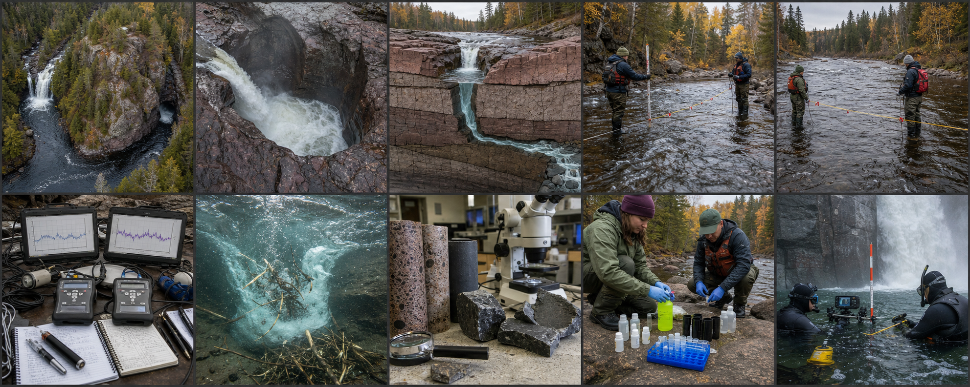
Image note: all ten visuals are original editorial reconstructions. The cutaway is a constrained hypothesis, not a surveyed geological section; the dye panel depicts a documented proposal rather than a completed test.